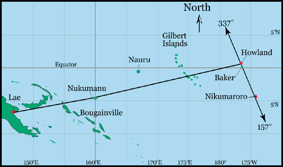
|
Copyright ©2009 by Paul Niquette. All rights reserved. |
|
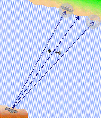  One solution to the
puzzle is shown in the
schematic flight plan on the right. It calls for
deliberately taking up a heading
to the right of the direct course by an angle that
corresponds to the maximum expected steering error
during the over-water flight. One solution to the
puzzle is shown in the
schematic flight plan on the right. It calls for
deliberately taking up a heading
to the right of the direct course by an angle that
corresponds to the maximum expected steering error
during the over-water flight.
Doing that removes all ambiguity about
which way to turn if the destination is not
immediately identified upon reaching the shoreline:
Specifically one simply turns left and follows
the shoreline.
Obviously, the course line could have been intentionally offset to the left, with turning to the right after completing the over-water flight. The decision about which plan to adopt may be influenced by several factors...
The term
'landfall' can be used as a metaphor for any elongated
geographical feature on the surface that crosses the
course line. Here is a real-life case drawn from
memory of a flight in the 1980s before GPS came
along to revolutionize avigation.
The two-hour flight originated north of Monterey in
California with a destination at South County Airport in
San Martín. An afternoon overcast concealed the
ground west of the coastal foothills, and haze in the
valleys toward the east limited visibility to about a
mile.
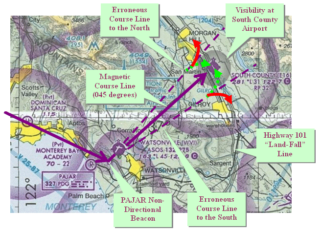
Accordingly, I decided to apply Landfall Navigating by taking up a heading of 055 (10 degrees to the right of the intended course) thereby obviating a turn away from the airport, as indicated by the green arrows in the sketch on the right. The procedure will often be advisable even when the pilot has no visible "landfall" line but instead an elapsed time flying at a known groundspeed from some previous fix.
|
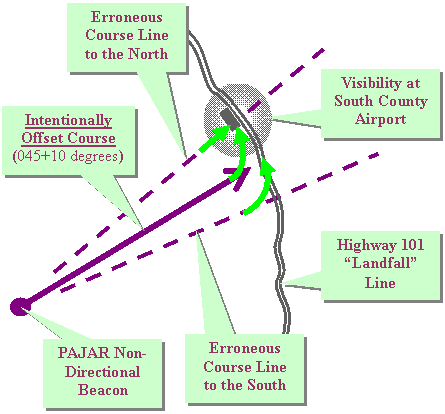 Turning the wrong way, though, would
have been an embarrassment for the pilot.
After more than two hours aloft, my passengers, for
personal reasons, were eager to get on the ground.
Turning the wrong way, though, would
have been an embarrassment for the pilot.
After more than two hours aloft, my passengers, for
personal reasons, were eager to get on the ground.